| STUDY GUIDE USII.2 -- Geography | |
| The
student will use maps, globes, photographs, pictures, and tables for a) explaining how physical features and climate influenced the movement of people westward; WHITE TYPE - FROM VDOE CURRICUMUM
FRAMEWORK |
|
|
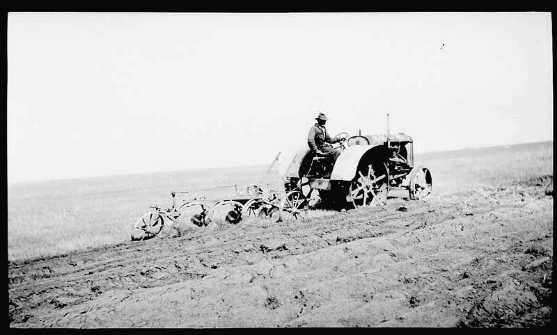
Encouraged by the Homestead Act of 1862 which gave willing farmers land on the Great Plains, and new technologies which allowed people to live in more challenging environments, farmers and immigrants flocked to the Great Plains during the decades after the Civil War. People began to see the Great Plains no as a "treeless wasteland" but as a vast area to be settled.
·
•
Steel plows
•
|
|
     CLICK on these photos to enlarge them |
|
| The student will
use maps, globes, photographs, pictures, and tables for b) explaining relationships among natural resources, transportation, and industrial development after 1877. |
|
| How did advances in
transportation link resources, products, and markets? Advances in transportation linked resources, products, and markets. • Transportation of resources - Railroads - Railroads could reach interior areas, including places where an inadequate water supply or rough terrain made canals impossible. By 1840, the United States had almost three thousand miles of track; by 1860, a network of thirty thousand miles linked most of the nation's major cities and towns. • Moving natural resources (e.g., copper and lead) to eastern factories Copper and lead mines discovered in New Mexico, Arizona, and Utah. It was shipped by rail to eastern factories. • Moving iron ore deposits to sites of steel mills (e.g., Pittsburgh) In the mid-1800s, huge, easily mined deposits of high-grade iron ore were discovered in Michigan, Minnesota, and Wisconsin. Because iron ore could be transported more economically than coal, the other ingredient needed for steel, iron ore was shipped by rail to Pittsburgh. By 1860 Pittsburgh became the center for the emerging new steel industry. The need for armaments in the Civil War gave a great boost to the city’s iron industry. The new Bessemer process allowed iron and coal to be converted cheaply into steel, which was manufactured into a variety of products - from nails to rails. • Transporting finished products to national markets Producers used the railroads to ship raw materials to factories and to send manufactured goods from factories to markets around the U.S. What are some examples of manufacturing areas that were located near centers of population? 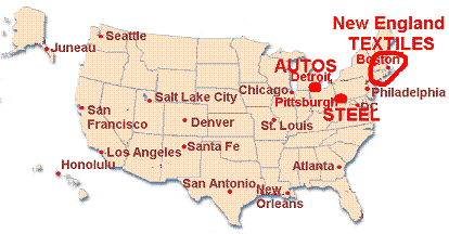 Examples of manufacturing areas clustered near centers of population. • Textile industry—New England • Automobile industry—Detroit • Steel industry—Pittsburgh |
|
| The student
will use maps, globes, photographs, pictures, and tables for c) locating the 50 states and the cities most significant to the historical development of the United States. |
|
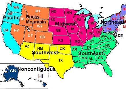
Explain that states are grouped by region as follows:·
Northeast: Maine, Vermont, New Hampshire, Connecticut,
Massachusetts, Rhode Island, New York, New Jersey, Pennsylvania |
 |
|
Explain how cities serve as centers of trade and have historically had political, economic, and cultural significance to the development of the United States. Provide examples of cities, including the following: ·
Northeast: New York, Boston, Pittsburgh,
Philadelphia |
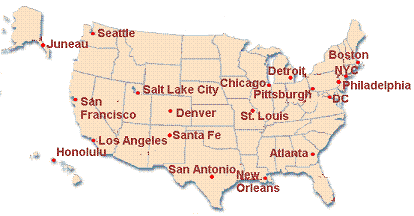 |
| Santa Fe
- Capital of New Mexico - During the 1850's, many
people headed west on the Santa Fe trail which stretched from Independence,
Missouri to Santa Fe. From Santa Fe, other trails took travelers on to
California and elsewhere. San Antonio - Texans here staged a revolt against Mexican rule, but were slaughtered by Mexican General Santa Anna at the Alamo. With the battle cry "Remember the Alamo", Texans eventually captured the Mexican dictator and Texas became an independent republic. New York City - By 1850, already the most populated American city. Most immigrants arrived at Ellis Island. Many remained in NYC and many moved to other parts of the U.S. Pittsburgh - Steel manufacturing center Chicago - Center of meat packing industry Detroit - Center of automobile industry
MORE CITY DESCRIPTIONS TO COME! |
|
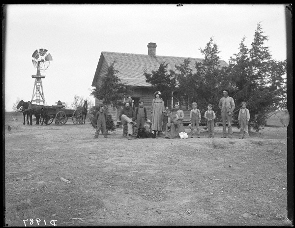
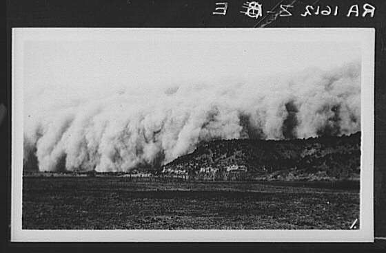
 Living
on the Great Plains presented many challenges. The winters were bitter cold.
There were few rivers and streams for water, and few trees for wood. Low
rainfall caused drought and dust storms. Fierce winds and frequent dust
storms eroded and blew away the soil. The remaining tough soil was thought
to be unsuitable for farming. Before the Civil War, the Great Plains were
considered a "treeless wasteland".
Living
on the Great Plains presented many challenges. The winters were bitter cold.
There were few rivers and streams for water, and few trees for wood. Low
rainfall caused drought and dust storms. Fierce winds and frequent dust
storms eroded and blew away the soil. The remaining tough soil was thought
to be unsuitable for farming. Before the Civil War, the Great Plains were
considered a "treeless wasteland".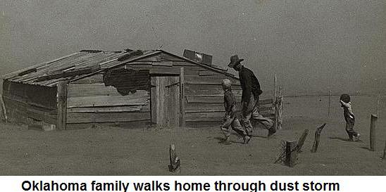
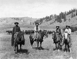 • Beef
Cattle Raising
• Beef
Cattle Raising 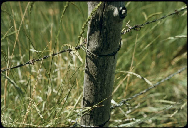
 • Barbed wire
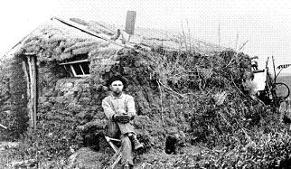
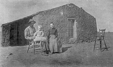
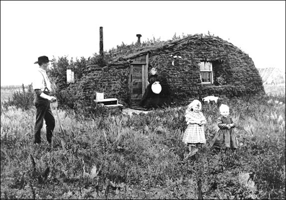
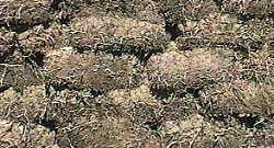 • Sod houses